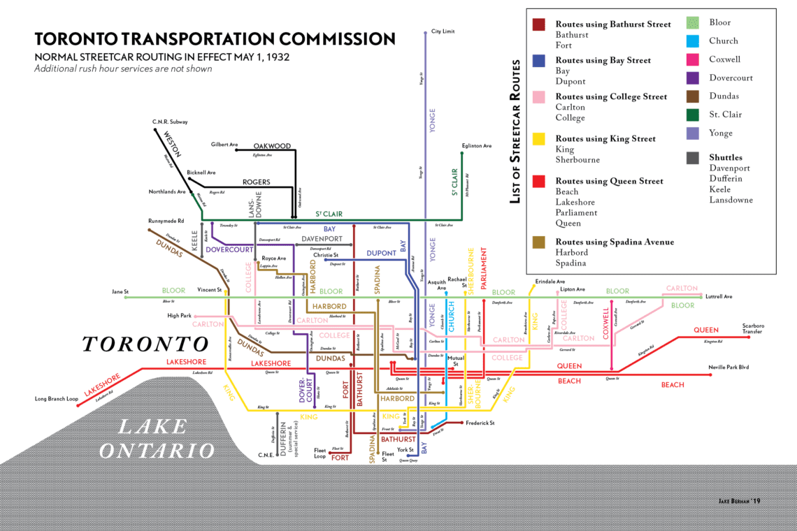
In the 1930s the TTC had streetcar routes running all over the city. Last week, I stumbled across this great map of the TTC’s streetcar routes in 1932 and this week we have a listing out right now in Danforth Village, one of the areas in the city that developed from the 1910s thru the 1930s as a streetcar suburb along the Danforth streetcar line. Most of the housing to the north and south of the street dates from this period. In 1966 the Bloor-Danforth subway line replaced the streetcar. The neighbourhood is currently served by six subway stations: Donlands, Greenwood, Coxwell, Woodbine, Main Street, and Victoria Park.
TTC Streetcar map 1932

artist, graphic designer, cartographer.

A Roger Puta Photograph
More information can be found here: https://transit.toronto.on.ca/streetcar/4115.shtml