
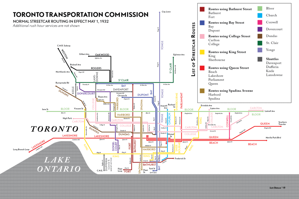
In the 1930s the TTC had streetcar routes running all over the city.
During the 1910s, 20s, and 30s, many areas in Toronto such as the Danforth Village were intentionally developed as streetcar suburbs. Most of the housing to the north and south of the street dates from this period. With reliable transit service to this (at the time) outskirt neighbourhood, residents could enjoy the laid-back ambience of the Danforth’s family-oriented communities without sacrificing convenience.
In 1966 the Bloor-Danforth subway line replaced the streetcar. The neighbourhood is currently served by six subway stations: Donlands, Greenwood, Coxwell, Woodbine, Main Street, and Victoria Park.
TTC Streetcar Map 1932

Need Toronto real estate advice? Explore these related readings for helpful insights.
- How to Have Your Home on the Market in One Month
- Managing a Multiple Offer Scenario
- Staging Your Home to Sell: Should You Hire a Professional?
Should You Live Near Public Transit?
Today the TTC is one of the most used public transit networks in all of North America. According to the City, more than 1.7 million riders rely on the TTC’s buses, streetcars, and subway service to get to work, school, and wherever else they may be heading.
From a real estate perspective, owning a home close to public transit has its perks! Along with making life a little more convenient (even if you primarily drive), homes located close to TTC stops and stations see a boost in property value compared to those that aren’t.
Looking to make real estate moves in Toronto? We can help! Call us at 416-903-3695 or send us an email at team@mutchpropertygroup.com.
